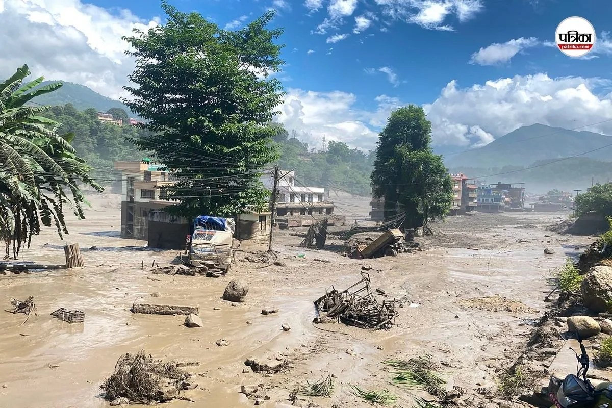
Emergency response mechanisms during extreme hydrological events reveal systemic vulnerabilities in geographic infrastructure and operational coordination. When flash floods sweep through mountainous terrain, the immediate physical isolation of communities creates a dual crisis: immediate physical rescue and subsequent long-term resource tracking. The Trishuli River corridor in Nepal serves as a stark case study where high-altitude geography collides with high-velocity water displacement, transforming localized river basins into zones of acute operational friction.
The Mechanics of Hydraulic Displacement in Narrow River Valleys
Mountainous river basins possess specific hydrological characteristics that accelerate disaster severity. The Trishuli River, characterized by steep gradients and constricted banks, concentrates kinetic energy during heavy monsoon precipitation. When volumetric capacity is exceeded, water velocity increases exponentially rather than linearly, dragging debris, sediment, and structural remnants downstream. Recently making headlines recently: Why This Supersized El Nino Means 2027 Will Break Weather Records.
[Heavy Monsoon Rainfall]
       │
       ▼
[Steep Terrain Runoff Concentration]
       │
       ▼
[Constricted River Channel Bottleneck]
       │
       ▼
[Exponential Velocity & Kinetic Energy Surge]
       │
       ▼
[Infrastructure Fractures & Isolation]
This dynamic creates distinct operational zones:
- Upstream Capture Zones: High-altitude precipitation zones where rapid runoff overwhelms soil saturation points, triggering mass wasting and slope failures.
- Midstream Transport Channels: Constricted gorges where water volume creates maximum sheer stress, destroying bridges, commercial installations, and transit cables.
- Downstream Deposition Plains: Areas where energy dissipates, leaving behind heavy silt loads, displaced debris, and stranded populations.
Infrastructure failure during these events follows a predictable cascade. Traditional transit architecture, such as suspension bridges and low-lying vehicular crossings, acts as physical anchors that catch floating debris. Once these points trap logs and sediment, they form temporary dams. The eventual structural blowout sends a high-energy wall of water downstream, neutralizing structural defenses within minutes. Further details on this are explored by The New York Times.
Ad-Hoc Engineering and Tactical Improvisation
When institutional disaster management systems experience latency, local populations rely on ad-hoc tactical engineering. The utilization of commercial adventure infrastructure—specifically zipline cables originally engineered for tourism—during the Trishuli flood events exemplifies extreme improvisation under resource constraints.
While these cable systems successfully facilitated emergency rope-transfers of stranded individuals across uncrossable currents, they highlight severe structural limitations in crisis management:
- Load-Bearing Mismatch: Commercial ziplines are calibrated for dynamic human loads within specific weight tolerances, not continuous, multi-directional evacuation pressures or heavy debris impacts.
- Power and Control Dependencies: Gravity-fed or motor-assisted systems lack the redundancy required when electrical grids fail due to upstream mudslides or transformer destruction.
- Tension Fatigue: Unscheduled high-frequency evacuation usage places torsion stress on anchor points that were engineered for recreational use, risking catastrophic cable snap.
This reliance on tourism assets for disaster rescue exposes a critical gap in municipal resilience planning. Civil defense strategies frequently fail to integrate commercial recreational assets into formal evacuation maps, leaving rescue operations dependent on local ingenuity rather than pre-engineered operational redundancy.
Information Asymmetry and the Missing Persons Bottleneck
Beyond physical rescue, catastrophic hydrological events generate severe information asymmetry. In the aftermath of the Trishuli incidents, tracking missing persons—such as those associated with monastic communities along the river banks—became severely bottlenecked by communication failures and decentralized reporting mechanisms.
The information lifecycle during a flash flood breaks down across three distinct phases:
- Immediate Disruption (Hours 0-12): Telecommunication towers washed out or deprived of backup power. Physical access roads blocked by landslides, preventing ground-truth assessment by central authorities.
- Fragmented Reporting (Hours 12-48): Localized accounts emerge via satellite phones or surviving terrestrial signals. Discrepancies arise between family reports, monastery rosters, and official rescue tallies.
- Consolidation and Verification (Days 2-7): Establishment of centralized command posts. Cross-referencing missing tourist registries, local resident logs, and downstream recovery operations.
Monastic and remote institutional settings present unique tracking challenges. These communities often maintain decentralized administrative records, and transient visitors, pilgrims, or volunteers may be present without formal digital registration. Consequently, post-disaster missing persons counts fluctuate wildly, delaying targeted search-and-rescue deployments in specific river segments.
Resource Allocation and Logistics Under Terrain Constraints
Deploying heavy rescue equipment to mountainous river corridors involves severe logistical friction. Standard heavy machinery, such as hydraulic cranes and amphibious recovery vehicles, cannot be rapidly deployed when arterial highways are severed by multiple landslides.
Effective resource deployment requires a modular logistical framework:
- Aero-Mobility Integration: Reliance on rotary-wing aircraft for initial reconnaissance and trauma extraction when ground routes are impassable. Rotorcraft capacity, however, remains constrained by high-altitude air density, unpredictable monsoon wind shear, and limited fuel depot infrastructure.
- Human-Portable Search Units: Deployment of specialized alpine rescue teams equipped with lightweight communications gear, thermal imaging, and swift-water survival equipment.
- Upstream-Downstream Coordination Hubs: Establishing communication nodes every five kilometers along river banks to track floating debris and human displacement, reducing the search radius from hundreds of square kilometers to manageable sector grids.
Geographic isolation cannot be entirely engineered away, but the friction of response can be minimized through pre-positioned cache networks. Communities situated within high-risk Himalayan river basins require localized supplies of satellite communication terminals, independent micro-grid generators, and high-tensile rope rescue kits stored above historical floodlines.
Institutionalizing these micro-depots shifts disaster response from reactive improvisation to structured containment. The operational mandate moving forward requires municipal planners to map commercial infrastructure not as separate tourist entities, but as secondary emergency lifelines embedded directly within regional risk mitigation models.