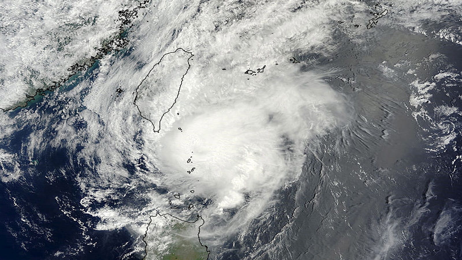
Managing catastrophic meteorological events requires more than standard reactive deployment; it demands a tiered bureaucratic response calibrated against precise hydrological thresholds. When Typhoon Noul approached the southern coast of China, the state disaster apparatus did not rely on generalized warnings. Instead, the administration initiated a multi-layered activation protocol across Guangdong, Jiangxi, and Hunan, moving emergency tiers upward as ocean telemetry verified atmospheric intensification over the northeastern South China Sea.
Understanding how regional disaster management operates under severe pressure requires deconstructing the architecture of institutional flood control, soil saturation mechanics, and the economic friction caused by mandatory logistical shutdowns.
The Tiered Bureaucratic Mechanics of Disaster Activation
China operates a four-tier emergency response matrix for floods and typhoons, where Level I represents the maximum catastrophic threshold requiring nationwide mobilization, and Level IV indicates baseline early monitoring and localized preparation. The operational acceleration during the approach of Typhoon Noul followed a rigorous escalation curve.
The State Flood Control and Drought Relief Headquarters executed this escalation through three distinct structural maneuvers:
- Baseline Tier Activation: The Ministry of Water Resources established Level IV responses across vulnerable provincial zones including Fujian, Jiangxi, Henan, Hubei, Hunan, Guangdong, and Guangxi. This phase mandates continuous radar tracking, daily hydrological consultations, and the prepositioning of Ministry work teams.
- Upgraded Regional Enforcement: As atmospheric pressure at the storm center dropped to approximately 965 hPa and sustained winds reached force 12 to 13 near the Pearl River Estuary, authorities elevated Guangdong's response specifically to Level III. This structural shift transfers authority to provincial command centers, empowering local units to enforce mandatory evacuations and suspend public infrastructure.
- Cross-Departmental Synchronization: The Ministry of Emergency Management integrated data streams from the China Meteorological Administration and the Ministry of Water Resources to evaluate localized topographical risks, targeting specific vulnerabilities such as small-to-medium reservoirs and mountain torrent channels.
This cascading structure removes ambiguity from local decision-making. Municipal leaders do not evaluate weather data in a vacuum; they execute pre-engineered operational directives tied directly to meteorological telemetry such as wind velocity vectors and projected rainfall volume.
Hydrological Load Calculations and the Threat Vector
The primary danger of tropical cyclones traversing southern China lies not exclusively in coastal storm surge, but in cumulative precipitation totals interacting with pre-saturated ground. Meteorological agencies projected rainfall amounts between 500 and 600 millimeters (20 to 24 inches) across targeted zones in Guangdong, Jiangxi, and Hunan.
When analyzing the physics of such an inundation, analysts must evaluate the soil absorption coefficient alongside river basin capacity:
- Pre-Existing Soil Saturation: Much of southern China endured persistent heavy rainfall cycles earlier in the season. Consequently, the water table sat near maximum capacity, reducing the soil's infiltration rate to near zero.
- Surface Runoff Acceleration: With infiltration suppressed, nearly 100 percent of incoming precipitation translates directly into surface runoff. This fluid volume funnels immediately into tributaries feeding major waterways like the Pearl River and Yangtze basins.
- Topographical Choke Points: As storm tracks drive inland, rugged terrain forces rapid orographic lifting, intensifying rainfall rates while the physical barrier disrupts the storm's rotational energy. This dynamic creates severe flash-flood risks in narrow river valleys and mountainous districts.
The combination of high-velocity onshore winds and heavy inland rain creates a dual-threat vector. Coastal areas face extreme wave heights and storm surges, while interior provinces face delayed, high-volume riverine flooding that persists long after surface winds have diminished.
The Economic Friction of Infrastructure Shutdowns
Mitigating loss of life requires a calculated suspension of economic and logistical activity. As Typhoon Noul targeted the corridor between Hong Kong and Huilai, regional authorities implemented widespread shutdowns to minimize population exposure in transit zones.
The operational friction manifested across multiple sectors:
- Transportation Paralysis: Over 410 flights were grounded in Hong Kong alongside the cancellation of more than 150 high-speed and conventional train services throughout Guangdong. Rail operators halted services systematically to prevent structural derailments caused by track washout or wind-borne debris.
- Commercial and Educational Stoppages: Municipalities like Chaozhou suspended all on-campus educational activities. Coastal hubs such as Zhuhai shuttered maritime ferry operations, forced fishing fleets back to port, and closed coastal tourism facilities.
- Evacuation Logistics: More than 20,000 residents in high-risk coastal and low-lying zones were relocated prior to landfall. The economic cost of these preemptive measures represents a deliberate trade-off: incurring immediate productivity losses to eliminate catastrophic rescue expenditures post-disaster.
These interventions illustrate the cost function of emergency response. The efficiency of a civil defense network is measured by its ability to halt complex urban logistics rapidly without inducing systemic panic.
Operational Directives for Downstream Resilience
Mitigating future meteorological shocks of this magnitude requires shifting from reactive evacuation management to predictive infrastructure hardening. Regional authorities must prioritize three structural optimizations:
- Automated Spillway Regulation: Integrate real-time sensor arrays in small and medium-sized reservoirs with automated discharge valves, removing human delay in managing water retention limits during rapid precipitation events.
- Dynamic Transport Routing: Replace rigid, blanket transportation suspensions with algorithmic corridor closures that maintain critical supply chains while isolating high-risk wind tunnels.
- Watershed Urban Planning: Redesign urban drainage networks in the Pearl River Delta to account for compound hazard scenarios where high tide, storm surge, and peak river discharge occur simultaneously.


