Ink is never just ink. On parchment or on a high-resolution digital display glowing in a basement office in Jefferson City, ink is a boundary. It is a fence line drawn through backyards, a quiet decree separating neighbors who share a grocery store, a church pew, and a local high school football team.
When lines move, lives tilt.
To understand what happens when an appeals court wrestles with a congressional map while a Supreme Court block hovers like a distant thunderstorm, you have to stop looking at the state from three thousand miles up. Forget the satellite view of red and blue blobs. Look closer. Look at the kitchen table in a farmhouse outside Columbia, Missouri, where the coffee is cooling and the calendar is marked with dates that feel less like appointments and more like approaching weather fronts.
For months, the citizens of Missouri have lived inside a geometry experiment not of their making. Boundaries were stretched. Communities of interest—neighborhoods bound by shared economies, shared struggles, and shared history—were sliced apart with the sterile precision of a cartographer’s stylus.
Consider a hypothetical resident named Clara. Clara has lived in her district for thirty years. She knows the local river when it floods in the spring; she knows the potholes on Main Street that the county council keeps forgetting to fix. Her vote, whether cast for a Democrat or a Republican, was part of a conversation with her immediate neighbors. They shared the same representative, someone who had to show up at the county fair, eat the fried pie, and look them in the eye.
Then came the new lines.
Suddenly, Clara’s vote was tethered to a community two hours away, a place with entirely different economic arteries, different worries, different rhythms of life. To her representative, she was no longer a neighbor at the grocery store; she was a pixel on a demographic spreadsheet, a calculated percentage in a partisan equation designed to lock in power for a decade.
This is what happens when law and geography collide in a courtroom.
The legal battle over Missouri’s congressional map is dense with procedural friction. Words like stay, injunction, jurisdiction, and merits bounce off courtroom walls with academic dryness. The United States Supreme Court entered the fray earlier, putting a temporary thumb on the scale, freezing certain elements while leaving lower courts to sort out the wreckage of federal and state constitutional claims. Now, the appellate court weighs the pieces. Judges read briefs filled with expert testimony on compactness, partisan bias, and racial fairness. They pore over algorithmic analyses that prove a map could have been drawn ten thousand different ways, each yielding a different flavor of political outcome.
Yet, behind the briefs and the oral arguments lies a simpler, heavier truth: power protects itself.
Redistricting is often described as politicians choosing their voters rather than voters choosing their politicians. That phrase has been repeated so often it risks becoming wallpaper, hiding the machinery behind it. But walk into a local county clerk’s office when the new maps drop, and you will see what it actually means. You will see election workers staring at computer screens, shaking their heads, trying to figure out which precinct a particular rural mail route belongs to now. You will see candidates who spent years building trust in a specific town suddenly told their base has been carved out and handed to someone else across the district.
It creates a strange kind of civic vertigo.
Democracy relies on a fragile currency called trust. It requires citizens to believe that the rules of the game are fair, even when their preferred candidate loses. When maps are redrawn mid-decade, or dragged through endless litigation until voters no longer know who represents them or what district they inhabit, that trust frays. People check out. They stop attending city council meetings. They stop calling their congressional offices. They look at the shifting lines and conclude that the game is rigged from the top down.
And yet, resistance takes root in the most stubborn places.
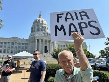
In Missouri, local organizers, grassroots legal teams, and ordinary citizens have refused to treat the maps as destiny. They have shown up at hearings with binders full of local data, arguing passionately that their towns belong together. They have reminded the courts that a map is not just a canvas for political engineering; it is a mirror of a society.
When the appeals court hands down its decision, the legal ripples will be felt far beyond the Show-Me State. Other states watching this dance will take notes. They will see how far a legislature can push the envelope before the judiciary steps in, or conversely, how much deference courts will grant to elected officials who draw the very lines that keep them in office.
The legal machinery grinds on. Briefs are filed. Judges deliberate. The Supreme Court's shadow looms large over every sentence written in the appellate chambers.
But out here, on the ground, the map remains.
Clara pours another cup of coffee. She looks out the window at the morning mist rising over the pasture, wondering where her voice will land when the next election arrives. The ink on the map is dry, but the soil beneath it is still shifting. And the people who live on that soil are waiting to see if the law will finally catch up to the reality of their lives.