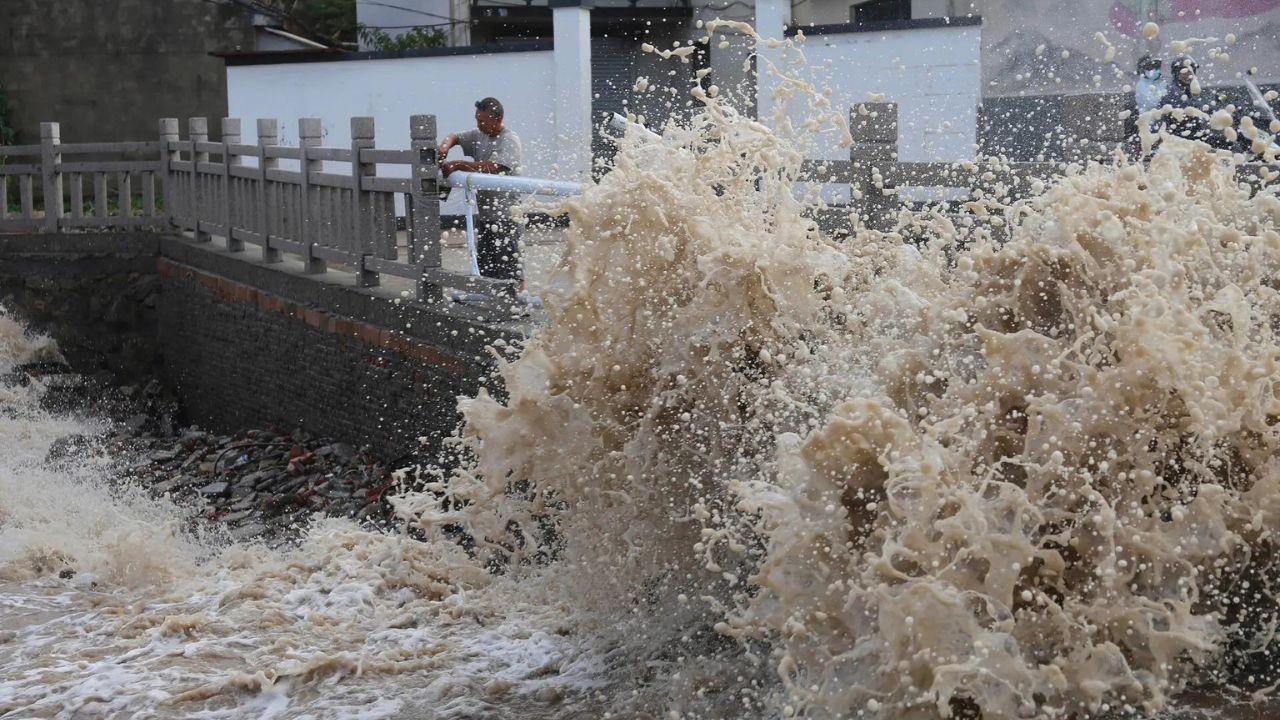
Mass civilian evacuation under short-notice meteorological stress tests the limits of municipal infrastructure and centralized logistics. The landfall of Typhoon Bavi in Zhejiang province—specifically near Yuhuan—serves as a primary case study in preventative risk mitigation. By moving more than 1.7 million people out of high-risk zones prior to the storm's arrival, regional authorities demonstrated the mechanics of a modern hyper-scaled evacuation protocol.
Understanding the execution of this operation requires shifting focus away from sensational headlines and toward the specific structural frameworks, resource allocations, and logistical bottlenecks that dictate survival outcomes in high-density coastal economies. You might also find this related coverage insightful: Why the New York Times Needs the Government to Subpoena Its Reporters.
The Dual-Alert Framework: Decoupling Wind and Precipitation Risks
The primary operational error in standard disaster reporting is treating a tropical cyclone as a uniform hazard. In reality, a typhoon presents two distinct destructive vectors that require decoupled emergency responses: kinetic wind damage and volumetric water accumulation.
The state meteorological response to Typhoon Bavi deployed a simultaneous dual-alert mechanism to address these distinct threats. As extensively documented in latest reports by USA Today, the results are widespread.
                  ┌────────────────────────┐
                  │   Typhoon Bavi Track   │
                  └───────────┬────────────┘
                              │
             ┌────────────────┴────────────────┐
             ▼                                 ▼
┌────────────────────────┐         ┌────────────────────────┐
│  Orange Typhoon Alert  │         │ Red Rainstorm Warning  │
├────────────────────────┤         ├────────────────────────┤
│ • Kinetic Wind Hazard  │         │ • Volumetric Water Risk│
│ • Sustained Winds:     │         │ • Orographic Lift Ampl.│
│   144 km/h (89 mph)    │         │ • Urban Inundation     │
│ • Coastal Zoning       │         │ • Catchment Overload   │
└────────────────────────┘         └────────────────────────┘
The National Meteorological Center issued an Orange Typhoon Alert, the second-highest level in the national four-tier system. This alert addresses kinetic wind hazards. With maximum sustained winds measuring 144 km/h (89 mph) near the center—the structural equivalent of a Category 1 hurricane—the wind profile dictates immediate coastal zoning actions. These actions include mandating that maritime vessels return to port, securing or dismantling high-altitude construction equipment, and halting open-air commercial activity.
Simultaneously, authorities activated the year's first Red Rainstorm Warning, the absolute highest tier for precipitation. This decoupling is vital. While wind speeds degrade rapidly due to surface friction upon landfall, volumetric precipitation often intensifies due to orographic lift when moisture-laden maritime air encounters inland topography. The Red Rainstorm Warning signals that local water catchment systems, reservoir networks, and urban drainage infrastructure are at immediate risk of capacity failure.
The Economics of Preventative Evacuation
Relocating over 1.7 million citizens within a 48-hour window is an exercise in asset management and economic trade-offs. The financial footprint of such an operation spans direct state expenditure, capital preservation, and systemic economic friction.
Capital Allocation and Direct Relief Funds
The central government allocated 40 million yuan ($5.9 million USD) in natural disaster relief funds specifically to support preventative operations and early-stage emergency rescue in Zhejiang and Fujian provinces. In a data-driven model, this capital functions as an insurance premium designed to minimize a much larger potential liability.
Direct relief funds are distributed across three primary operational categories:
- Logistical Subsidies: Fuel, vehicle deployment, and personnel overtime for transport networks moving citizens to designated safe zones.
- Supply Chain Provisioning: Securing and distributing short-term caloric intake, potable water, medical supplies, and temporary bedding across thousands of municipal shelters.
- First Responder Readiness: Deploying and maintaining specialized equipment for the 17,000 emergency rescue workers placed on standby in Fujian province alone.
Systemic Economic Friction
The true cost of the evacuation extends far beyond state fund allocation. Halting economic activity to preserve human life introduces severe systemic friction. The preventative protocols for Typhoon Bavi mandated structural shutdowns across the eastern seaboard:
- Transit Interdiction: The wholesale cancellation of hundreds of flights, suspension of coastal ferry lines, and localized shutdowns of the high-speed rail network completely froze the regional supply chain.
- Labor Halt: Closing schools, offices, and manufacturing hubs across major economic centers like Wenzhou (a city of 10 million residents) and parts of Shanghai effectively halts gross domestic product generation for the duration of the storm cycle.
Structural Vulnerabilities and Cascading Hazards
A critical assessment of Typhoon Bavi’s trajectory highlights the compounding nature of meteorological events. This storm did not strike an isolated system; it arrived as the second major tropical cyclone to hit the region in just over a week, trailing closely behind Typhoon Maysak. This tight temporal spacing creates a phenomenon known as hazard compounding, where the second event exploits the systemic vulnerabilities left by the first.
Saturation and Catchment Overload
When a geography experiences back-to-back storms, the soil’s infiltration capacity is exhausted. The heavy rains from Typhoon Maysak left regional river basins and urban soils near total saturation. Consequently, the precipitation brought by Typhoon Bavi could not be absorbed by the ground, converting nearly 100% of the rainfall into immediate surface runoff. This creates an acute bottleneck for urban drainage systems and drastically accelerates the timeline for flash flooding.
Topographical Triggers: The Landslide Mechanism
The lethal reality of this moisture accumulation was demonstrated during Bavi's developmental phase. As the system enhanced seasonal monsoon rains over the Philippines, it triggered catastrophic landslides in southern provinces like Sarangani and Lanao del Sur, resulting in at least 17 fatalities.
The underlying physics of these failures involve pore-water pressure. As heavy rain infiltrates sloped topography, water fills the spaces between soil particles. The resulting increase in pore-water pressure reduces the shear strength of the soil, neutralizing the internal friction that holds the hillside in place. When gravity overcomes this degraded structural integrity, a debris flow occurs. Eastern China's mountainous interior faces identical geological risks, necessitating the proactive evacuation of upland villages in Zhejiang and Fujian.
Operational Logistics: The Mechanics of the Evacuation Blueprint
The relocation of nearly two million people is not achieved through simple civilian compliance; it is enforced through a rigid, tiered administrative hierarchy. China’s response grid operates via a top-down mobilization model that divides territory into micro-zones, ensuring accountability and clear communication channels.
┌────────────────────────────────────────────────────────┐
│               Central Government Directive             │
│            (Resource Allocation & Mandates)            │
└───────────────────────────┬────────────────────────────┘
                            ▼
┌────────────────────────────────────────────────────────┐
│              Provincial Emergency Command              │
│          (Zhejiang / Fujian / Shanghai Units)         │
└───────────────────────────┬────────────────────────────┘
                            ▼
┌────────────────────────────────────────────────────────┐
│                Municipal Grid Managers                 │
│         (Door-to-Door Validation & Transport)          │
└───────────────────────────┬────────────────────────────┘
                            ▼
┌────────────────────────────────────────────────────────┐
│              Targeted High-Risk Population             │
│       (1.7M+ Zhejiang | 100K+ Fujian | 34K Shanghai)   │
└────────────────────────────────────────────────────────┘
The operational blueprint for Typhoon Bavi relied on specific spatial data:
- Low-Lying Maritime Zones: Moving populations living in structures below predicted storm surge heights or within unstable coastal dwellings.
- Shanghai Flash Points: The relocation of approximately 34,000 residents from high-risk, low-lying urban pockets in Shanghai by noon on Saturday.
- Fujian Onshore Relocation: Moving more than 3,700 individuals from exposed coastal positions in Ningde, Fujian, by Friday evening.
The execution relies on municipal grid managers who go door-to-door to validate that evacuations are complete, clear transportation corridors, and guide residents into designated public facilities.
The primary limitation of this model is its high dependence on mandatory compliance and rigid state infrastructure. While highly effective at minimizing casualties in regions with absolute administrative oversight, attempting to replicate this blueprint in decentralized economies faces severe friction, including legal challenges over forced displacement, a lack of standardized community-level tracking, and fragmented public communication channels.
Strategic Playbook for Industrial and Supply Chain Continuity
For enterprise operations and supply chain managers operating within the East China economic corridor, weathering a dual-alert typhoon scenario requires executing a precise operational playbook rather than waiting for ad-hoc municipal directives.
Step 1: Execute the Inventory Decoupling Protocol
As soon as an Orange Typhoon Alert is active, companies must halt the Just-In-Time (JIT) inventory model. Buffers must be established at inland fulfillment hubs outside the immediate coastal red-zone. High-value components should be moved to vertical storage facilities above predicted flood levels, and maritime shipments must be re-routed to deep-water ports further north or south of the storm's projected landfall radius.
Step 2: Implement Real-Time Facility Hardening
Facility managers must transition industrial plants into passive preservation modes. This requires isolating power grids to prevent surge damage from grid fluctuations, securing outdoor capital equipment, and verifying that backup diesel generators have a minimum of 72 hours of fuel supply, completely independent of local grid infrastructure.
Step 3: Pivot to Post-Saturation Logistics
Supply chain routing maps must be dynamically updated to bypass known topographic bottlenecks. Given the high probability of landslides and localized flooding following back-to-back typhoons, transit routes must avoid mountainous passes and coastal highways. Freight should be systematically shifted to high-capacity inland rail links or delayed until local authorities verify road bed structural integrity.

.webp)