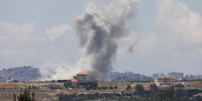
The strategic calculus of northern Israeli military operations depends on a singular geographic and tactical threshold: the Litani River. When Prime Minister Benjamin Netanyahu released video footage confirming Israeli Defense Forces (IDF) operations across this waterway, the announcement was treated by standard media outlets as a symbolic milestone. In reality, crossing the Litani represents a fundamental shift in the regional security architecture, moving from a defensive border-containment posture to an active buffer-zone enforcement strategy.
Evaluating the operational reality behind this development requires moving past political rhetoric. Assessing the strategic implications of this deployment reveals the specific friction points, logistical constraints, and structural dynamics that dictate whether this crossing is a temporary tactical deep-raid or a permanent geopolitical realignment.
The Strategic Geography of the Litani River Basin
The Litani River runs roughly parallel to the Israeli-Lebanese border before turning sharply westward to empty into the Mediterranean Sea north of Tyre. This geographic bend creates a natural barrier that has defined military planning in the region since 1978.
[North: Central/Northern Lebanon]
========================================= Litani River Barrier
[South: The Buffer Zone / Southern Lebanon]
========================================= Blue Line / International Border
[Israel: Northern Galilee]
To understand the military necessity of crossing this line, one must analyze the area through three distinct operational vectors.
The Topographical Bottleneck
The terrain south of the Litani is characterized by rugged, limestone hills, deep wadis, and highly defensible high ground. For decades, non-state actors utilized this fragmented geography to construct decentralized, subterranean fortification networks. The river itself serves as a natural moat. By breaching this line, the IDF shifts the theater of engagement, disrupting the rear-guard logistics, supply depots, and command nodes that feed the forward defensive lines closer to the Blue Line.
The Stand-off Trajectory Equation
The primary security driver for northern Israel is the mitigation of short-range ballistic trajectories, specifically anti-tank guided missiles (ATGMs) and unguided Katyusha-class rockets.
- Direct-Fire Threats: Modern ATGMs require direct line-of-sight and have operational ranges between 4 to 10 kilometers. Forcing hostile elements north of the Litani eliminates direct-fire capabilities against Israeli civilian infrastructure in the Galilee.
- Indirect-Fire Geometry: While longer-range rockets can easily overfly the river, removing short-range launchers from the immediate border zone severely degrades the adversary's high-volume, low-warning saturation capabilities, allowing iron dome batteries higher interception efficiency due to increased tracking time.
Resolution 1701 Structural Failure
The United Nations Security Council Resolution 1701, established in 2006, mandated that no armed personnel, assets, or weapons other than those of the Lebanese Government and UNIFIL should be deployed between the Blue Line and the Litani River. The current crossing by the IDF is the physical manifestation of the structural failure of this international enforcement mechanism. Because international monitoring bodies lacked the mandate or the political will to enforce the demilitarized zone, a security vacuum formed. The IDF crossing represents a unilateral transition from diplomatic reliance to physical enforcement.
Logistical Vulnerabilities and the Cost Function of Deep Penetration
Crossing a river barrier is one of the most hazardous operations a mechanized military can undertake. Maintaining a footprint north of the Litani introduces a steep cost function that escalates non-linearly with time and depth.
Supply Line Elasticity
Every kilometer advanced north of the international border increases the vulnerability of supply convoys. The roads leading down to and up from the Litani River valley are narrow, winding, and highly susceptible to ambushes, improvised explosive devices (IEDs), and choke-point interdiction.
[Border Depots] ---> [Wadi Transit Corridors] ---> [River Crossing Points] ---> [Forward Units]
      |                       |                            |                        |
(Secure Zone)         (Ambush Vectors)             (Target Bottlenecks)      (Extended Perimeter)
Amphibious bridging equipment or captured transit points become high-value targets. If forward units cannot secure the high ground flanking these transit corridors, the river transforms from a protective barrier against northern threats into a barrier trapping Israeli forces on the wrong side of the bank.
The Force Multiplication Deficit
Holding ground requires significantly more manpower than clearing ground. A rapid maneuver force can bypass pockets of resistance to plant a flag or film a press briefing. However, transitioning that maneuver into an enduring defensive line means establishing forward operating bases, air defense perimeters, and continuous electronic warfare screening. This diverts combat brigades from other critical theaters, stressing the reserve component of the military and compounding the domestic economic strains associated with long-term mobilization.
Operational Intelligence Asymmetry
While the IDF possesses absolute superiority in aerial surveillance, signals intelligence, and precision-strike capabilities, physical occupation degrades this technological edge. Once troops are stationary north of the river, they are exposed to localized human intelligence networks, asymmetrical hit-and-run tactics, and short-range mortar fire that neutralizes long-range early warning systems. The technological advantage shifts from a macro-level asset to a micro-level defensive shield.
The Geopolitical Escalation Matrix
The confirmation of troops crossing the Litani triggers immediate counter-moves from regional and international state actors. This dynamic can be mapped using a standard escalation matrix based on structural dependencies.
| Actor | Primary Strategic Objective | Probable Counter-Action | Structural Limitation |
|---|---|---|---|
| Lebanese Armed Forces (LAF) | Preservation of state sovereignty and internal cohesion | Passive non-engagement; defensive positioning away from IDF axes | Total lack of heavy anti-armor and modern air defense assets |
| Regional Patron State (Iran) | Preservation of deterrence proxy networks | Increased shipments of advanced weaponry via Syrian corridors; cyber operations | Economic isolation; risk of direct kinetic retaliation on domestic soil |
| United States | Containment of a wider regional conflict; maritime trade stability | Diplomatic pressure to formalize a revised border framework; intelligence sharing boundaries | Domestic political constraints; commitment to Israeli security guarantees |
The crossing fundamentally alters the bargaining positions of all involved parties. For Israel, the physical presence north of the river is a high-stakes bargaining chip. The strategic objective is to create a reality where any future diplomatic settlement does not merely repeat the text of Resolution 1701, but establishes a verifiable, enforced, and physical mechanism to prevent the remilitarization of the southern sector.
Operational Limitations and Risk Profiles
No military strategy is devoid of systemic vulnerabilities. A critical analysis of the Litani crossing reveals three glaring limitations that commanders must manage to prevent a tactical victory from devolving into a strategic quagmire.
First, the mission creep trap is highly pronounced. History demonstrates that entering southern Lebanon to establish a security buffer often leads to an incremental expansion of the operational zone. If rocket fire persists from positions just north of the new line, the logic of the buffer zone dictates a further push northward, expanding the perimeter until the lines of communication break under their own weight.
Second, the political-military decoupling risk presents a severe bottleneck. A military force can execute a crossing flawlessly, clearing the banks and neutralizing immediate threats. However, if the political echelon lacks a clear, realistic end-state—whether that is an international peacekeeping force with real enforcement teeth, a bilateral treaty, or a long-term unilateral withdrawal plan—the military footprint stagnates. Stagnation breeds vulnerability, turning a dynamic maneuver force into static targets for asymmetric attrition.
Third, the regional distraction factor must be quantified. Every asset deployed north of the Litani—every Iron Dome battery redirected to protect the crossing corridors, every elite commando unit clearing ridges—is an asset removed from monitoring other strategic fronts, including the southern borders, western maritime routes, and deeper regional ballistic threats.
The ultimate success of the Litani crossing will not be measured by the cinematic quality of the footage released by the Prime Minister's office. It will be determined by the IDF’s capacity to convert a localized geographic breach into a sustainable, defensible, and politically leverageable security paradigm that permanently alters the risk calculus of its adversaries. The military mechanics have succeeded in crossing the water; the strategic challenge now lies in managing the political currents that follow.