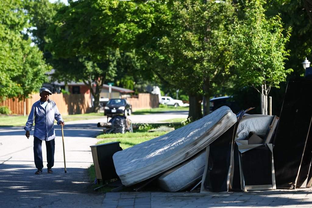
Municipal infrastructure collapses not from chronic degradation alone, but when concentrated meteorological phenomena bypass historical design thresholds entirely. When the Township of Southwold in southwestern Ontario declared a state of emergency following an extreme precipitation event, public reporting focused on flooded basements and submerged vehicles. A structural examination reveals a precise hydraulic failure: roughly two hundred thirty millimeters of rain dropped in approximately ninety minutes, creating a discharge rate that conservative drainage engineering models classify as a two-hundred-fifty-year event. This analysis deconstructs the mechanics of that failure, mapping how localized meteorological stalling, agricultural runoff vectors, and legacy civil engineering intersect to create catastrophic municipal vulnerability.
The Meteorological Vector: Stationary Convective Cells
Standard rainfall projections rely on historical intensity-duration-frequency curves. These statistical instruments fail during localized convective anomalies. In Southwold, the primary driver was not a fast-moving frontal system distributing volume across a regional watershed, but rather slow-moving, training thunderstorms anchored along the north shore of Lake Erie.
The mechanics of this meteorological trap involve three distinct variables:
- Atmospheric moisture saturation levels feeding continuous localized cell regeneration.
- Surface wind convergence zones holding the storm core stationary over specific communities like Shedden and Fingal.
- Extreme precipitation rates exceeding ninety millimeters per hour, which instantly saturate the topsoil layer and eliminate infiltration capacity.
When precipitation rates outpace soil absorption capacity by an order of magnitude, the ground behaves effectively as an impermeable surface. Every subsequent millimeter of rain transitions directly into surface sheet flow.
The Hydrological Cost Function: Agricultural Runoff and Topography
Rural municipalities present unique hydrological dynamics compared to urban centers. While cities rely on storm sewers, rural areas depend on ditches, culverts, and natural agricultural drainage networks.
The Southwold flood exposed the limits of these agrarian drainage systems through a clear physical chain reaction:
- Flat agricultural fields surrounding rural hamlets act as vast catchment basins during intense downpours.
- Tilled topsoil, lacking root matrix cohesion during late summer harvest cycles, erodes and enters drainage channels, reducing their cross-sectional hydraulic radius.
- As ditches fill, water spills over rural concession roads, which frequently act as low-profile gravity dams or unintentional spillways.
The kinetic energy of water moving across unpaved shoulders and asphalt edges generates immediate structural scour. Roads do not merely flood; the sub-base material washes out entirely, turning transit corridors into high-velocity drainage flumes capable of displacing motor vehicles.
The Structural Deficit of Legacy Infrastructure
Municipalities operate under capital replacement cycles that span decades, whereas extreme weather frequency indices are shifting upward on a near-annual basis. Culvert sizing standards across southern Ontario were historically engineered using mid-twentieth-century precipitation frequency tables.
When a two-hundred-fifty-year storm occurs within a ninety-minute window, three structural bottlenecks manifest simultaneously:
- Culvert orifice capacity becomes instantly choked, causing upstream pooling that overtops road grades.
- Bridges and civil assets experience hydrodynamic pressure loads that exceed their static design tolerances.
- Emergency response networks face absolute spatial fragmentation as primary and secondary evacuation corridors simultaneously wash out, isolating pockets of the municipality.
Declaring a state of emergency functions primarily as a legal and administrative instrument to bypass normal procurement hurdles, unlock provincial disaster relief frameworks, and mobilize heavy equipment resources beyond standard municipal maintenance contracts. It is a tactical override of bureaucratic latency in the face of physical destruction.
Strategic Capital Allocation for Climate Resilience
Mitigating future events of this magnitude requires moving away from reactive infrastructure repair and toward dynamic capacity modeling. Municipalities facing similar hydrological risks must re-engineer drainage pathways based on upper-bound convective storm data rather than historical moving averages.
Engineering departments should prioritize the following operational transitions:
- Upscaling culvert diameter thresholds by a factor of two in identified topographical low points and agricultural convergence zones.
- Installing real-time telemetry sensors in critical municipal drainage arteries to track flash-rise metrics before road overtopping occurs.
- Restructuring rural zoning and conservation partnerships to create intentional retention basins and engineered floodways that protect population centers from unmitigated agricultural runoff.
The Southwold event demonstrates that rural infrastructure is routinely under-calibrated for modern convective extremes. Without structural redesign of drainage corridors, municipal emergency declarations will transition from anomalous administrative interventions to routine components of local governance.