High-altitude mountain systems operate under precarious thermal and mechanical equilibria. When these thresholds fail, the resulting cascade bypasses traditional meteorological warning systems entirely. Optical and radar satellite platforms monitoring the Nepal-China border sector during recent flash flood events documented a structural shift in alpine terrain. Rather than a conventional precipitation-driven river overflow, orbital imagery captured a catastrophic high-altitude mass movement originating from the Langtang Lirung massif. Deconstructing this event requires analyzing the mechanical interplay between glacial snout detachment, bedrock failure, and downstream hydraulic amplification.
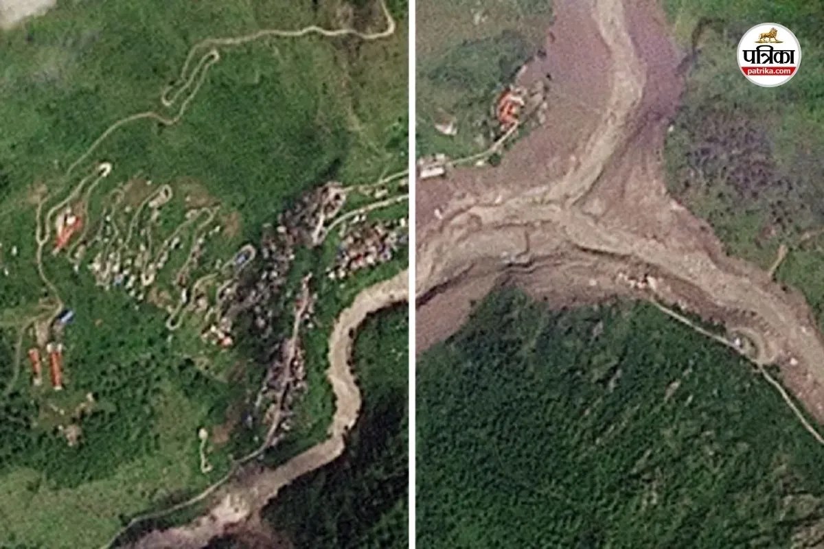
The mechanics of the initial failure sequence defy standard flood forecasting models. Pre-event and post-event orbital comparisons reveal that approximately two-thirds of a targeted glacial body, anchored near 5,200 meters elevation, detached alongside its underlying bedrock matrix. This was not a slow creep or a localized surface melt, but an instantaneous structural collapse. Geomorphological analysis indicates that the kinetic energy released by millions of tons of ice and rock plunging roughly 1,200 meters into the Lhende Khola valley functioned analogously to a high-yield explosive detonation.
Permafrost degradation acts as the primary underlying variable in these scenarios. For millennia, frozen interstitial ice serves as structural cement for steep rock faces and hanging glaciers. As regional atmospheric warming trends accelerate, this thermal baseline shifts. The transition of permafrost from solid to liquid phase introduces pore-water pressure, diminishes frictional resistance along structural shear planes, and uncouples glaciers from their bedrock foundations. When combined with localized thermal spikes that strip protective snow cover and expose bare ice, the structural safety factor of the slope drops below unity.
Once the initial ice-rock avalanche impacts the valley floor, the physical properties of the mass shift dynamically. Solid material liquefies upon impact due to intense dynamic stress and frictional heating, entraining river sediments, boulders, and riparian vegetation. This transforms a dry avalanche into a high-density debris flow. The fluid mechanics of a hyper-concentrated debris surge differ fundamentally from clear-water floods. Density increases dramatically, allowing the torrent to transport massive tectonic boulders and structural infrastructure with minimal velocity loss.
Hydraulic routing through narrow Himalayan gorges compounds downstream vulnerability. As the debris surge entered the Bhote Koshi and Trishuli river networks, it repeatedly created temporary natural dams before breaching violently. These intermittent blockages and subsequent dynamic failures produce a pulsating wave front. Hydrological monitoring stations recorded extreme river level spikes, such as a nine-meter vertical rise within a thirty-minute window at downstream checkpoints. Such velocity gradients eliminate evacuation windows for human settlements situated within the active floodplain.
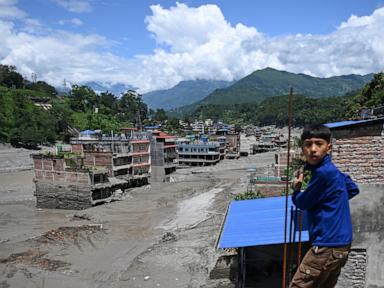
Infrastructure resilience metrics in these high-risk corridors face structural obsolescence. Traditional engineering paradigms assume design floods based on historical discharge records and predictable monsoon rainfall distributions. Debris avalanches originating from glacial collapses introduce solid-phase volumes that block bridge spans, bury multi-story border facilities, and obliterate hydro-power installations within minutes. The Rasuwagadhi crossing and surrounding valley settlements were rendered unrecognizable not through water immersion alone, but via the volumetric displacement of solid sediment loads that essentially raised the valley floor level permanently.
Risk mitigation strategies must shift from reactive disaster response to predictive geospatial monitoring. Remote sensing infrastructure now permits near-real-time identification of thermal anomalies, surface velocity vectors, and tension cracks in high-altitude hanging glaciers. Regional warning architectures require automated integration with seismic networks, as catastrophic slope failures generate distinct low-frequency ground motion signatures that can trigger downstream acoustic alarms before physical fluid waves arrive. Infrastructure planning across transnational Himalayan corridors must incorporate mandatory high-elevation setback zones and sediment-retention traps designed to absorb massive solid-phase surges rather than relying solely on conventional channel containment.